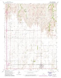
1965 Map of Galva
USGS Topo · Published 1980About this map
The town of Galva serves as a focal point in this 1960s Kansas landscape, situated at the junction of the Chicago Rock Island and Pacific and the Atchison Topeka and Santa Fe railroads. The map illustrates a rural society organized by township boundaries such as Delmore and Empire, where local life centered around landmarks like the Harmony Sch and North Diamond Community Hall. The presence of the Chindberg Oil Field and various oil fields suggests the significance of energy extraction alongside traditional agriculture.
Find a feature on this map
27 named features on this map. Tap any name to fly to it.
Don’t see what you’re looking for? This feature index may not catch every label — zoom into the map to look around manually.
Map Details
Editions of this 1965 Galva Map
3 editions found

Other maps of this area

1889 · Newton
USGS Topo · 1:125,000

1889 · Abilene
USGS Topo · 1:125,000

1891 · Hutchinson
USGS Topo · 1:125,000

1892 · Salina
USGS Topo · 1:125,000

1893 · Hutchinson
USGS Topo · 1:125,000

1894 · Newton
USGS Topo · 1:125,000

1894 · Abilene
USGS Topo · 1:125,000

1942 · Salina
USGS Topo · 1:125,000

1955 · Hutchinson
USGS Topo · 1:250,000

1959 · Hutchinson
USGS Topo · 1:250,000