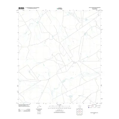
2013 Map of Galvan Ranch
USGS Topo · Published 2013About this map
Galvan Ranch and Snakel Ranch serve as the primary human landmarks in this portion of Webb County, defining a landscape dominated by extensive ranching operations. The area is etched by an intricate network of drainage systems, including the winding course of Santa Isabel Cr and the southern reaches of Cuchara Cr. To the north, Tierra Blanca Cr and Chalker Cr further delineate the terrain, illustrating the seasonal water patterns essential to life in this South Texas environment. The sparse distribution of structures and the convergence of local ranch roads highlight the remote, specialized nature of land use in this region during the early twenty-first century.
Find a feature on this map
6 named features on this map. Tap any name to fly to it.
Don’t see what you’re looking for? This feature index may not catch every label — zoom into the map to look around manually.
Map Details
Editions of this 2013 Galvan Ranch Map
This is the sole edition of this map. No revisions or reprints were ever made.
Other maps of this area

1923 · Palafox
USGS Topo · 1:62,500

1929 · Cotulla
USGS Topo · 1:125,000

1940 · Velenzuela Creek
USGS Topo · 1:62,500

1940 · San Loranzo Creek
USGS Topo · 1:62,500

1953 · Crystal City
USGS Topo · 1:250,000

1955 · Crystal City
USGS Topo · 1:250,000

1956 · Las Tiendas
USGS Topo · 1:62,500

1956 · Laredo
USGS Topo · 1:250,000

1961 · Crystal City
USGS Topo · 1:250,000

1965 · Spohn Ranch
USGS Topo · 1:24,000