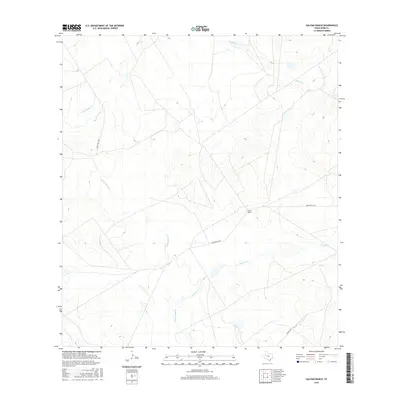
2016 Map of Galvan Ranch
USGS Topo · Published 2016About this map
Galvan Ranch anchors this portion of Webb County, representing the long-standing ranching traditions of the South Texas brush country. The landscape is defined by an intricate network of intermittent drainage systems, most notably Santa Isabel Cr and Cuchara Cr, which reveal the hydrologic patterns essential to land management in this arid region. Other waterways, including Tierra Blanca Cr and Chalker Cr, carve subtle relief into the terrain. Transportation through these private lands is facilitated by a grid of dedicated routes such as Galvan Rd and Ranch Rd 6236A, reflecting the modern infrastructure required to maintain large-scale agricultural operations. This survey provides a precise look at the intersection of natural creek beds and managed ranch boundaries in the early twenty-first century.
Find a feature on this map
8 named features on this map. Tap any name to fly to it.
Don’t see what you’re looking for? This feature index may not catch every label — zoom into the map to look around manually.
Map Details
Editions of this 2016 Galvan Ranch Map
This is the sole edition of this map. No revisions or reprints were ever made.
Other maps of this area

1923 · Palafox
USGS Topo · 1:62,500

1929 · Cotulla
USGS Topo · 1:125,000

1940 · Velenzuela Creek
USGS Topo · 1:62,500

1940 · San Loranzo Creek
USGS Topo · 1:62,500

1953 · Crystal City
USGS Topo · 1:250,000

1955 · Crystal City
USGS Topo · 1:250,000

1956 · Las Tiendas
USGS Topo · 1:62,500

1956 · Laredo
USGS Topo · 1:250,000

1961 · Crystal City
USGS Topo · 1:250,000

1965 · Spohn Ranch
USGS Topo · 1:24,000