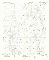
1955 Map of Ganado 1 NE
USGS Topo · Published 1962About this map
Petrified Forest National Monument and the Navajo Indian Reservation converge in this high-desert landscape of the mid-1950s. The terrain is defined by the gradual ascent toward the Defiance Plateau to the northeast, deeply etched by the seasonal drainage of Bis-ii-ah Wash and Nazlini Wash. The map reflects a remote ranching and grazing environment where water management is paramount, indicated by the distribution of several tanks and a windmill strategically placed across the arid flats. Survey markers like Snake and Vabm 5995 provide precise topographical fixed points amidst the complex system of nameless canyons and washes, including the eastern Tah-aith-cheed Wash. This preliminary survey captures the intersection of protected federal lands and tribal territory before more extensive road networks or modern developments altered the region.
Find a feature on this map
17 named features on this map. Tap any name to fly to it.
Don’t see what you’re looking for? This feature index may not catch every label — zoom into the map to look around manually.
Map Details
Editions of this 1955 Ganado 1 NE Map
This is the sole edition of this map. No revisions or reprints were ever made.
Other maps of this area

1886 · Fort Defiance
USGS Topo · 1:250,000

1892 · Fort Defiance
USGS Topo · 1:250,000

1892 · Canyon De Chelly
USGS Topo · 1:250,000

1954 · Shiprock
USGS Topo · 1:250,000

1954 · Gallup
USGS Topo · 1:250,000

1955 · Zith-Tusayan Butte 2 SW
USGS Topo · 1:24,000

1955 · Zith-Tusayan Butte 2 NW
USGS Topo · 1:24,000

1955 · Chinle 4 SE
USGS Topo · 1:24,000
1955 · Sonsala Butte 3 SW
USGS Topo · 1:24,000
1955 · Canyon Del Muerto
USGS Topo · 1:62,500