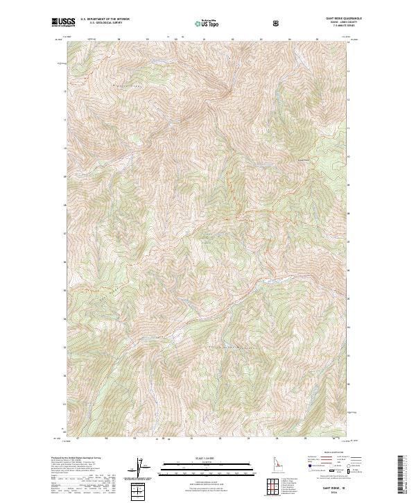
2024 Map of Gant Ridge
USGS Topo · Published 2024About this map
The Frank Church-River of No Return Wilderness and Salmon National Forest dominate this high-elevation portion of Lemhi County, defined by the towering Bighorn Crags and the Yellowjacket Mountains. This 2024 survey documents a landscape preserved for its primitive character, where travel is dictated by a network of established paths like the Gant Ridge Trl and Lick Creek Trl. Drainage systems are prominent, with Big Deer Creek and its many tributaries, including South Fork Big Deer Creek, carving through the steep topography. The map illustrates how administrative boundaries and natural features converge at points like Indian Point and along the spine of Gant Ridge. This modern topographic study is essential for understanding the contemporary management and untouched drainage basins of central Idaho’s most protected lands.
Find a feature on this map
24 named features on this map. Tap any name to fly to it.
Don’t see what you’re looking for? This feature index may not catch every label — zoom into the map to look around manually.
Map Details
Editions of this 2024 Gant Ridge Map
This is the sole edition of this map. No revisions or reprints were ever made.
Other maps of this area

1950 · Blackbird Mtn
USGS Topo · 1:62,500

1951 · Blackbird Mtn
USGS Topo · 1:62,500

1956 · Elk City
USGS Topo · 1:250,000

1960 · Elk City
USGS Topo · 1:250,000

1960 · Shoup
USGS Topo · 1:62,500

1962 · Hoodoo Meadows
USGS Topo · 1:24,000

1962 · Long Tom Mtn
USGS Topo · 1:24,000

1962 · Mt Mc Guire
USGS Topo · 1:24,000

1982 · Bighorn Crags
USGS Topo · 1:100,000
1989 · Blackbird Mountain
USGS Topo · 1:24,000