
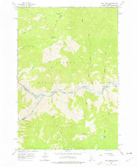
1962 Map of Long Tom Mtn
USGS Topo · Published 1964About this map
The confluence of the Salmon River and the Middle Fork Salmon River anchors this Idaho wilderness survey within the Salmon National Forest. This remote landscape, field checked in the early 1960s, is defined by the steep elevation changes between the riverbanks and high peaks like Long Tom Mountain. Cultural history is noted at the Indian Petroglyphs near Ebenezer Bar, while early 20th-century aviation and forest management are represented by the Airstrip and several lookouts, including Lookout VABM 8086. Logistics in this backcountry terrain relied on the Stoddard Bridge and the Bear Basin Trail, providing access to high-altitude points like Horse Heaven and the secluded Dome Lake. The map serves as a record of the primitive road and trail networks used before more modern infrastructure reached the deep river canyons.
Find a feature on this map
32 named features on this map. Tap any name to fly to it.
Don’t see what you’re looking for? This feature index may not catch every label — zoom into the map to look around manually.
Map Details
Editions of this 1962 Long Tom Mtn Map
3 editions found
Other maps of this area

1950 · Blackbird Mtn
USGS Topo · 1:62,500

1951 · Blackbird Mtn
USGS Topo · 1:62,500

1956 · Elk City
USGS Topo · 1:250,000

1960 · Elk City
USGS Topo · 1:250,000

1960 · Shoup
USGS Topo · 1:62,500

1962 · Square Top
USGS Topo · 1:24,000

1962 · Aggipah Mtn
USGS Topo · 1:24,000

1962 · Mt Mc Guire
USGS Topo · 1:24,000

1962 · Horse Creek Butte
USGS Topo · 1:24,000

1962 · Butts Creek Point
USGS Topo · 1:24,000