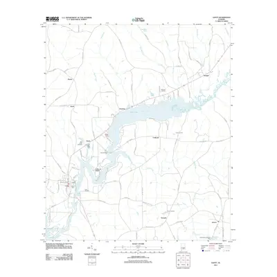
2011 Map of Gantt
USGS Topo · Published 2011About this map
The Conecuh River dominates this portion of south-central Alabama, its course shaped by significant hydraulic engineering at Gantt Dam and Billy Carter Lake Dam. These structures created the expansive waters of Gantt Lake, which serves as a central geographic anchor for nearby settlements like Gantt, Rawls, and Clearview. The map reveals a landscape defined by its river-bottom topography and a network of rural routes such as County Hwy-37 and Jordan Grove Rd.
Find a feature on this map
93 named features on this map. Tap any name to fly to it.
Don’t see what you’re looking for? This feature index may not catch every label — zoom into the map to look around manually.
Map Details
Editions of this 2011 Gantt Map
This is the sole edition of this map. No revisions or reprints were ever made.
Other maps of this area

1953 · Andalusia
USGS Topo · 1:250,000

1957 · Andalusia
USGS Topo · 1:250,000

1971 · Dozier
USGS Topo · 1:24,000

1971 · Industry
USGS Topo · 1:24,000

1971 · Brantley
USGS Topo · 1:24,000

1971 · River Falls
USGS Topo · 1:24,000

1971 · Andalusia
USGS Topo · 1:24,000

1971 · Gantt
USGS Topo · 1:24,000

1971 · Leon
USGS Topo · 1:24,000

1971 · Red Level
USGS Topo · 1:24,000