
1971 Map of Andalusia
USGS Topo · Published 1973About this map
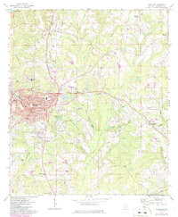
Andalusia serves as the regional hub for Covington County in the early 1970s, characterized by its dense street grid and significant educational landmarks like Andalusia College and the Montezuma Academy. The transportation landscape is defined by the intersection of the Central of Georgia and the Louisville and Nashville railroads, which facilitated the movement of goods through the surrounding pine lands and creek bottoms.
Find a feature on this map
77 named features on this map. Tap any name to fly to it.
Don’t see what you’re looking for? This feature index may not catch every label — zoom into the map to look around manually.
Map Details
Editions of this 1971 Andalusia Map
2 editions found
Other maps of this area

1953 · Andalusia
USGS Topo · 1:250,000

1957 · Andalusia
USGS Topo · 1:250,000

1971 · Carolina
USGS Topo · 1:24,000

1971 · Libertyville
USGS Topo · 1:24,000

1971 · Dozier
USGS Topo · 1:24,000

1971 · Onycha
USGS Topo · 1:24,000

1971 · River Falls
USGS Topo · 1:24,000

1971 · Gantt
USGS Topo · 1:24,000

1971 · Red Level
USGS Topo · 1:24,000
1971 · Opp West
USGS Topo · 1:24,000