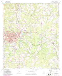
1971 Map of Andalusia
USGS Topo · Published 1986About this map
Andalusia serves as the central hub of this Covington County survey, showing a well-established mid-century municipal core defined by a network of educational and spiritual landmarks. The town's layout includes several schools such as Woodson Middle Sch and Three-Notch Sch, alongside the Montezuma Academy and Wallace College to the east. Transportation and logistics are anchored by the Seaboard railroad corridor and the Andalusia-Opp Airport, reflecting the era's regional connectivity.
Find a feature on this map
57 named features on this map. Tap any name to fly to it.
Don’t see what you’re looking for? This feature index may not catch every label — zoom into the map to look around manually.
Map Details
Editions of this 1971 Andalusia Map
2 editions found
Other maps of this area

1953 · Andalusia
USGS Topo · 1:250,000

1957 · Andalusia
USGS Topo · 1:250,000

1971 · Carolina
USGS Topo · 1:24,000

1971 · Libertyville
USGS Topo · 1:24,000

1971 · Dozier
USGS Topo · 1:24,000

1971 · Onycha
USGS Topo · 1:24,000

1971 · River Falls
USGS Topo · 1:24,000

1971 · Andalusia
USGS Topo · 1:24,000

1971 · Gantt
USGS Topo · 1:24,000

1971 · Red Level
USGS Topo · 1:24,000