
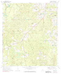
1971 Map of Carolina
USGS Topo · Published 1972About this map
Conecuh National Forest dominates the southern landscape of this 1971 survey, showing a heavily wooded terrain characterized by a dense network of seasonal drainages and local ponds. Small settlements like Carolina and Pleasant Home serve as the primary hubs of activity, connected by a winding rural road system. The presence of Carolina Ch and Shady Hill Ch, alongside the Shady Hill Cem, provides significant points of interest for genealogists tracing family roots in this corner of Covington County.
Find a feature on this map
30 named features on this map. Tap any name to fly to it.
Don’t see what you’re looking for? This feature index may not catch every label — zoom into the map to look around manually.
Map Details
Editions of this 1971 Carolina Map
2 editions found
Other maps of this area

1953 · Andalusia
USGS Topo · 1:250,000

1957 · Andalusia
USGS Topo · 1:250,000

1971 · Dixie
USGS Topo · 1:24,000

1971 · Bradley
USGS Topo · 1:24,000

1971 · Libertyville
USGS Topo · 1:24,000

1971 · Wing
USGS Topo · 1:24,000

1971 · River Falls
USGS Topo · 1:24,000

1971 · Andalusia
USGS Topo · 1:24,000
1971 · Watkins Bridge
USGS Topo · 1:24,000

1971 · Loango
USGS Topo · 1:24,000