
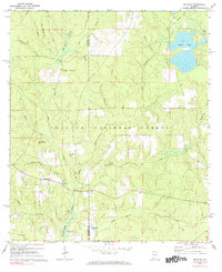
1971 Map of Bradley
USGS Topo · Published 1972About this map
Conecuh National Forest dominates this South Alabama landscape, where the confluence of numerous creeks feeds into the Blackwater River. The settlement of Bradley serves as the primary local hub, located near the junction of several drainage systems like Fish Trap Branch and Blackwater Creek. Local history is deeply embedded in the land, marked by the presence of Old Bradley Cem, Blackwater Cem, and the Bradley Ch.
Find a feature on this map
33 named features on this map. Tap any name to fly to it.
Don’t see what you’re looking for? This feature index may not catch every label — zoom into the map to look around manually.
Map Details
Editions of this 1971 Bradley Map
2 editions found
Other maps of this area

1948 · Munson
USGS Topo · 1:62,500

1949 · Crestview
USGS Topo · 1:62,500

1950 · Munson
USGS Topo · 1:62,500

1951 · Crestview
USGS Topo · 1:62,500

1953 · Andalusia
USGS Topo · 1:250,000

1957 · Andalusia
USGS Topo · 1:250,000

1957 · Pensacola
USGS Topo · 1:250,000

1959 · Pensacola
USGS Topo · 1:250,000

1960 · Pensacola
USGS Topo · 1:250,000

1971 · Dixie
USGS Topo · 1:24,000