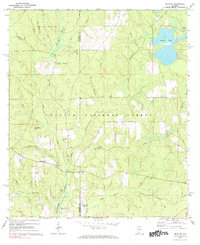
1971 Map of Bradley
USGS Topo · Published 1984About this map
Bradley serves as the primary settlement hub in this 1971 study of the southern Alabama borderlands, situated just north of the Florida line within the Conecuh National Forest. The landscape is defined by the winding course of the Blackwater River and its numerous tributaries, including Panther Creek and Fish Trap Branch. Local history and genealogy are well-represented by family and community landmarks such as Old Bradley Cem, Blackwater Cem, and the Union Hill Ch.
Find a feature on this map
33 named features on this map. Tap any name to fly to it.
Don’t see what you’re looking for? This feature index may not catch every label — zoom into the map to look around manually.
Map Details
Editions of this 1971 Bradley Map
2 editions found

Other maps of this area

1948 · Munson
USGS Topo · 1:62,500

1949 · Crestview
USGS Topo · 1:62,500

1950 · Munson
USGS Topo · 1:62,500

1951 · Crestview
USGS Topo · 1:62,500

1953 · Andalusia
USGS Topo · 1:250,000

1957 · Andalusia
USGS Topo · 1:250,000

1957 · Pensacola
USGS Topo · 1:250,000

1959 · Pensacola
USGS Topo · 1:250,000

1960 · Pensacola
USGS Topo · 1:250,000

1971 · Dixie
USGS Topo · 1:24,000