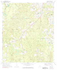
1971 Map of Carolina
USGS Topo · Published 1984About this map
Conecuh National Forest dominates the southern landscape of this Covington County region, where the terrain is defined by an intricate network of creeks and small ponds. The Conecuh River cuts through the northwest corner, fed by tributaries like Copeland Creek and Shady Bend Creek. Small rural communities are centered around local landmarks such as Carolina, which features the Carolina Ch, and the settlement of Pleasant Home further west.
Find a feature on this map
31 named features on this map. Tap any name to fly to it.
Don’t see what you’re looking for? This feature index may not catch every label — zoom into the map to look around manually.
Map Details
Editions of this 1971 Carolina Map
2 editions found
Other maps of this area

1953 · Andalusia
USGS Topo · 1:250,000

1957 · Andalusia
USGS Topo · 1:250,000

1971 · Dixie
USGS Topo · 1:24,000

1971 · Bradley
USGS Topo · 1:24,000

1971 · Carolina
USGS Topo · 1:24,000

1971 · Libertyville
USGS Topo · 1:24,000

1971 · Wing
USGS Topo · 1:24,000

1971 · River Falls
USGS Topo · 1:24,000

1971 · Andalusia
USGS Topo · 1:24,000
1971 · Watkins Bridge
USGS Topo · 1:24,000