
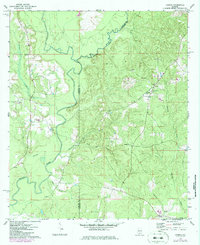
1971 Map of Loango
USGS Topo · Published 1973About this map
The Sepulga River and Pigeon Creek converge within a heavily wooded landscape straddling the line between Conecuh and Covington counties. Small rural settlements like Loango and Melrose are defined by their proximity to these watercourses and a network of unpaved roads. The area is dotted with small-scale agricultural clearings and significant local landmarks that speak to the community’s social fabric, including several rural congregations and family burial grounds.
Find a feature on this map
22 named features on this map. Tap any name to fly to it.
Don’t see what you’re looking for? This feature index may not catch every label — zoom into the map to look around manually.
Map Details
Editions of this 1971 Loango Map
2 editions found
Other maps of this area

1953 · Andalusia
USGS Topo · 1:250,000

1957 · Andalusia
USGS Topo · 1:250,000

1971 · Dixie
USGS Topo · 1:24,000

1971 · Brooks
USGS Topo · 1:24,000

1971 · Carolina
USGS Topo · 1:24,000

1971 · River Falls
USGS Topo · 1:24,000

1971 · Red Level
USGS Topo · 1:24,000

1982 · Damascus
USGS Topo · 1:24,000

1982 · Old Town
USGS Topo · 1:24,000
1982 · Brooklyn
USGS Topo · 1:24,000