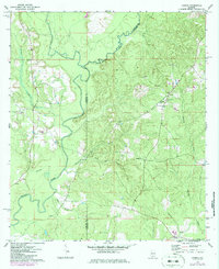
1971 Map of Loango
USGS Topo · Published 1986About this map
The Sepulga River and its major tributary, Pigeon Creek, define the landscape of this rural Alabama territory along the border of Conecuh and Covington counties. Surveyed in the early 1970s with mid-1980s updates, the map shows a network of small settlements such as Loango and Paul connected by winding secondary roads. The area is characterized by numerous country churches, including New Providence Ch and Bethesda Ch, which often serve as the focal points for local community life.
Find a feature on this map
21 named features on this map. Tap any name to fly to it.
Don’t see what you’re looking for? This feature index may not catch every label — zoom into the map to look around manually.
Map Details
Editions of this 1971 Loango Map
2 editions found
Other maps of this area

1953 · Andalusia
USGS Topo · 1:250,000

1957 · Andalusia
USGS Topo · 1:250,000

1971 · Dixie
USGS Topo · 1:24,000

1971 · Brooks
USGS Topo · 1:24,000

1971 · Carolina
USGS Topo · 1:24,000

1971 · River Falls
USGS Topo · 1:24,000

1971 · Red Level
USGS Topo · 1:24,000

1971 · Loango
USGS Topo · 1:24,000

1982 · Damascus
USGS Topo · 1:24,000

1982 · Old Town
USGS Topo · 1:24,000