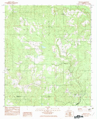
1982 Map of Brooklyn
USGS Topo · Published 1982About this map
Brooklyn sits near the confluence of the Sepulga River and several major tributaries along the border of Conecuh and Escambia counties. This 1982 provisional survey details a landscape defined by its intricate drainage network, including Amos Mill Creek, Polly Creek, and the winding path of Bottle Creek. The settlement pattern in this era is concentrated around small hubs like Spring Hill and Johnsonville, with rural land use evidenced by the scattered Cem locations and a dense web of unimproved roads and trails. The map serves as a record of South Alabama's interior before significant modern development, showing the prominence of water-named landmarks like Bearthick Creek, Rawls Creek, and Horton Branch in orienting local residents and property owners.
Find a feature on this map
16 named features on this map. Tap any name to fly to it.
Don’t see what you’re looking for? This feature index may not catch every label — zoom into the map to look around manually.
Map Details
Editions of this 1982 Brooklyn Map
This is the sole edition of this map. No revisions or reprints were ever made.
Other maps of this area

1953 · Andalusia
USGS Topo · 1:250,000

1957 · Andalusia
USGS Topo · 1:250,000

1971 · Dixie
USGS Topo · 1:24,000

1971 · Brooks
USGS Topo · 1:24,000

1971 · Loango
USGS Topo · 1:24,000

1982 · Shipps Creek
USGS Topo · 1:24,000

1982 · Evergreen
USGS Topo · 1:24,000

1982 · Damascus
USGS Topo · 1:24,000

1982 · Nymph
USGS Topo · 1:24,000

1982 · Old Town
USGS Topo · 1:24,000