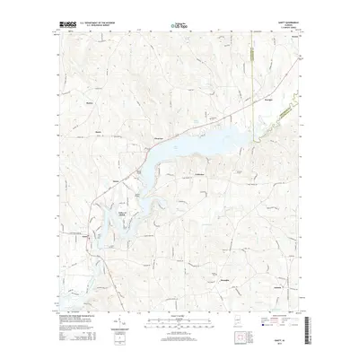
2014 Map of Gantt
USGS Topo · Published 2014About this map
Gantt Lake dominates the central landscape of this southern Alabama region, where the Conecuh River is impounded to form a complex waterway characterized by fingers and points like Rawls Point. The settlement pattern reflects a mix of small incorporated areas and rural clusters, with the town of Gantt situated at the southwestern edge of the lake and Dozier to the north. The area is marked by numerous family and community landmarks, including the Valley of Shiloh and several historic burial sites such as Bozeman Cem and Shiloh Cem. A network of country roads, such as Oakey Streak Rd and Bell Hill Rd, connects the scattered communities of Straughn, Antioch, and Searight. The presence of the Gantt Millpond south of the main lake suggests a legacy of local water-powered industry that once shaped the economy of these Covington and Crenshaw County borderlands.
Find a feature on this map
127 named features on this map. Tap any name to fly to it.
Don’t see what you’re looking for? This feature index may not catch every label — zoom into the map to look around manually.
Map Details
Editions of this 2014 Gantt Map
This is the sole edition of this map. No revisions or reprints were ever made.
Other maps of this area

1953 · Andalusia
USGS Topo · 1:250,000

1957 · Andalusia
USGS Topo · 1:250,000

1971 · Dozier
USGS Topo · 1:24,000

1971 · Industry
USGS Topo · 1:24,000

1971 · Brantley
USGS Topo · 1:24,000

1971 · River Falls
USGS Topo · 1:24,000

1971 · Andalusia
USGS Topo · 1:24,000

1971 · Gantt
USGS Topo · 1:24,000

1971 · Leon
USGS Topo · 1:24,000

1971 · Red Level
USGS Topo · 1:24,000