2024 Map of Gantt
USGS Topo · Published 2024About this map
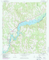
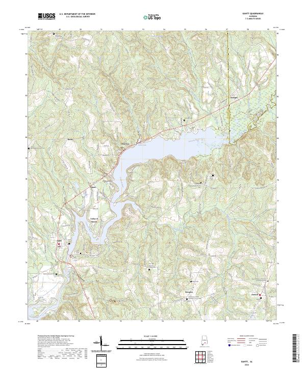
Gantt Lake serves as the central focal point of this landscape, where the Conecuh River is impounded north of the town of Gantt. The surrounding terrain is defined by a high density of rural religious and funerary sites, reflecting a deeply rooted community structure in this part of Covington County. Small settlements like Straughn, Rawls, and Antioch are anchored by their respective houses of worship and burial grounds, such as Zion Hill Baptist Church Cem and Mount Zion United Methodist Church. The geography is further shaped by numerous watercourses including Wolf Creek, Rocky Creek, and Feagin Creek, which carve through the timbered hills. Of particular interest to local historians is the Valley of Shiloh and the northern stretch of the river near Searight, where the boundary between Covington and Crenshaw counties follows the winding water and ridge lines.
Find a feature on this map
128 named features on this map. Tap any name to fly to it.
Don’t see what you’re looking for? This feature index may not catch every label — zoom into the map to look around manually.
Map Details
Editions of this 2024 Gantt Map
This is the sole edition of this map. No revisions or reprints were ever made.