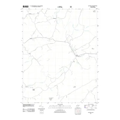
2011 Map of Gap Mills
USGS Topo · Published 2011About this map
Gap Mills and the surrounding Monroe County landscape are defined by the linear ridges of Gap Mountain and Peters Mountain, where the rural infrastructure of the early 21st century remains deeply rooted in historical settlement patterns. Central to this area is the Gap Mills Post Office and the Gap Mills Cemetery, serving as focal points for a series of small, dispersed communities including Hillsdale, Hollywood, and Crimson Springs. The drainage of Second Creek and its many tributaries, such as Plankcabin Creek and Forest Run, dictates the winding paths of the local road network, including Zenith Rd and Snow Rd. Along the high southern crest, the Hanging Rock Lookout Tower stands near Hanging Rock, offering a vantage point over the complex system of runs and branches that flow through the valleys, such as Tackett Branch and Back Creek. This map captures the enduring rural character of the region, where family names and local landmarks like Elk Knob and Cove Mountain anchor the geography.
Find a feature on this map
46 named features on this map. Tap any name to fly to it.
Don’t see what you’re looking for? This feature index may not catch every label — zoom into the map to look around manually.
Map Details
Editions of this 2011 Gap Mills Map
This is the sole edition of this map. No revisions or reprints were ever made.
Other maps of this area

1887 · Hinton
USGS Topo · 1:125,000

1887 · Lewisburg
USGS Topo · 1:125,000

1890 · Dublin
USGS Topo · 1:125,000

1890 · Christiansburg
USGS Topo · 1:125,000

1891 · Lewisburg
USGS Topo · 1:125,000

1891 · Dublin
USGS Topo · 1:125,000

1892 · Hinton
USGS Topo · 1:125,000

1921 · Alderson
USGS Topo · 1:48,000

1921 · Ronceverte
USGS Topo · 1:48,000

1923 · Ronceverte
USGS Topo · 1:62,500