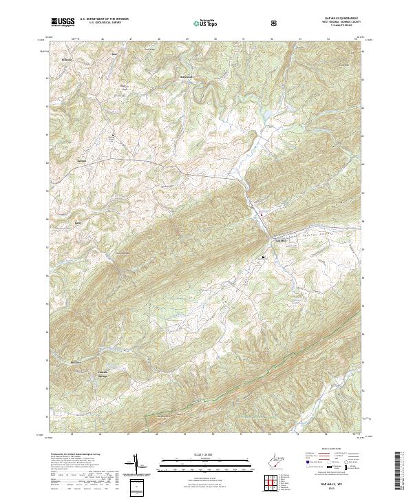
2023 Map of Gap Mills
USGS Topo · Published 2023About this map
Gap Mills sits at the foot of Gap Mountain where Kitchen Creek and Second Creek converge, anchoring a rural landscape defined by the long parallel ridges of Peters Mountain and Middle Mountain. This high valley terrain is marked by distinctive water sources like Crimson Springs and the Second Creek Spring Gap Mills Spring, which long influenced the location of crossroads settlements such as Keenan and Hillsdale. The southern portion of the quadrangle is largely occupied by the Jefferson National Forest, where the Allegheny Trail follows the high crest of the mountain.
Find a feature on this map
76 named features on this map. Tap any name to fly to it.
Don’t see what you’re looking for? This feature index may not catch every label — zoom into the map to look around manually.
Map Details
Editions of this 2023 Gap Mills Map
This is the sole edition of this map. No revisions or reprints were ever made.
Other maps of this area

1887 · Hinton
USGS Topo · 1:125,000

1887 · Lewisburg
USGS Topo · 1:125,000

1890 · Dublin
USGS Topo · 1:125,000

1890 · Christiansburg
USGS Topo · 1:125,000

1891 · Lewisburg
USGS Topo · 1:125,000

1891 · Dublin
USGS Topo · 1:125,000

1892 · Hinton
USGS Topo · 1:125,000

1921 · Alderson
USGS Topo · 1:48,000

1921 · Ronceverte
USGS Topo · 1:48,000

1923 · Ronceverte
USGS Topo · 1:62,500