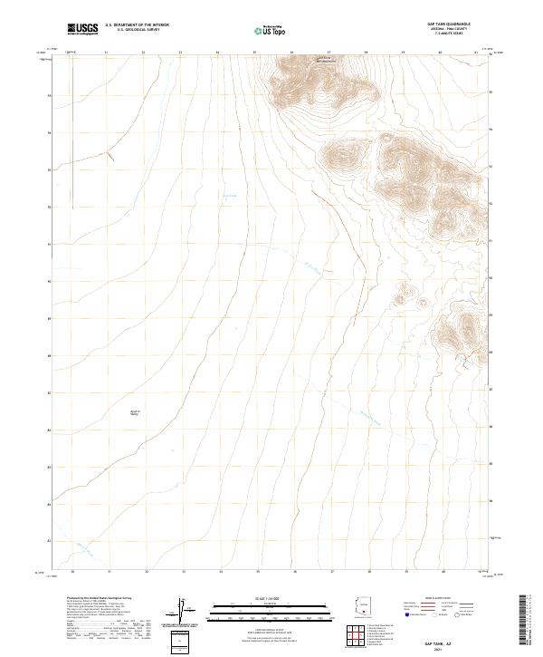
2021 Map of Gap Tank
USGS Topo · Published 2021About this map
The West Silver Bell Mountains dominate the northeastern corner of this desert landscape, where steep contours give way to the broad alluvial expanses of the Aguirre Valley. This area in Pima County is defined by its ephemeral drainage systems, including El Tiro Wash, Mammoth Wash, and Aguirre Wash, which carve through the arid terrain. The namesake Gap Tank sits isolated in the central portion of the sheet, representing a critical water catchment point in an otherwise dry environment. The cadastral grid of t11s r6e and t11s r7e organizes the territory, illustrating the intersection of natural topography and legal land divisions in the modern era.
Find a feature on this map
10 named features on this map. Tap any name to fly to it.
Don’t see what you’re looking for? This feature index may not catch every label — zoom into the map to look around manually.
Map Details
Editions of this 2021 Gap Tank Map
This is the sole edition of this map. No revisions or reprints were ever made.
Other maps of this area

1934 · Silver Bell
USGS Topo · 1:125,000

1942 · Silver Reef Mountains
USGS Topo · 1:62,500

1947 · Eloy
USGS Topo · 1:62,500

1948 · Eloy
USGS Topo · 1:62,500

1956 · Tucson
USGS Topo · 1:250,000

1958 · Tucson
USGS Topo · 1:250,000

1959 · Tucson
USGS Topo · 1:250,000

1959 · Vaca Hills
USGS Topo · 1:62,500

1962 · Tucson
USGS Topo · 1:250,000
1963 · Santa Rosa Mountains
USGS Topo · 1:62,500