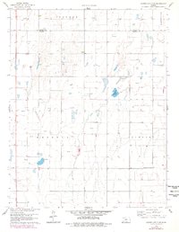
1959 Map of Garden City 3 NE
USGS Topo · Published 1978About this map
Wild Horse Lake sits as a primary hydrologic landmark in this western Kansas landscape, which is marked by the shifting boundaries of Ivanhoe and Lockport townships. The map documents an era of significant petroleum exploration, with dozens of gas wells scattered across the high plains, particularly north of the Finney and Haskell County line. This grid-based land pattern is interrupted only by natural depressions and the subtle topography of the Great Plains. The transition from the late 1950s to the late 1970s is captured through photogrammetric revisions, showing the expansion of rural infrastructure around the area of Pierceville and throughout Haskell County. These details provide a clear view of the mid-century agricultural and energy-driven economy that reshaped the region's flatlands.
Find a feature on this map
6 named features on this map. Tap any name to fly to it.
Don’t see what you’re looking for? This feature index may not catch every label — zoom into the map to look around manually.
Map Details
Editions of this 1959 Garden City 3 NE Map
3 editions found
Other maps of this area

1896 · Garden
USGS Topo · 1:125,000

1955 · Dodge City
USGS Topo · 1:250,000

1958 · Dodge City
USGS Topo · 1:250,000

1959 · Dodge City
USGS Topo · 1:250,000

1959 · Garden City 3 NW
USGS Topo · 1:24,000

1959 · Garden City 3 NE
USGS Topo · 1:24,000

1960 · Garden City SW
USGS Topo · 1:24,000

1960 · Garden City 3 SW
USGS Topo · 1:24,000

1960 · Garden City 3 SE
USGS Topo · 1:24,000

1960 · Plymell
USGS Topo · 1:24,000