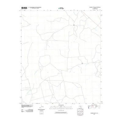
2010 Map of Garden City NE
USGS Topo · Published 2010About this map
North Concho River flows through the northeast corner of this West Texas landscape, defining a remote section of Glasscock County in 2010. The territory is characterized by large agricultural and ranching parcels, with Foster Ranch and Hilltop Ranch serving as the primary named landmarks in this sparsely populated region. Drainage patterns are established by seasonal watercourses like Dobson Creek and the East Fork Apple Creek, which carve through the high plains. A grid of local thoroughfares, including Co RD 307, provides the only access through these expansive grazing lands. The map illustrates a contemporary ranching economy where property boundaries and water access remain the most vital geographical features for local inhabitants.
Find a feature on this map
6 named features on this map. Tap any name to fly to it.
Don’t see what you’re looking for? This feature index may not catch every label — zoom into the map to look around manually.
Map Details
Editions of this 2010 Garden City NE Map
This is the sole edition of this map. No revisions or reprints were ever made.
Other maps of this area

1941 · Big Spring South
USGS Topo · 1:62,500

1942 · Big Spring South
USGS Topo · 1:62,500

1954 · Big Spring
USGS Topo · 1:250,000

1954 · San Angelo
USGS Topo · 1:250,000

1958 · San Angelo
USGS Topo · 1:250,000

1958 · Big Spring
USGS Topo · 1:250,000

1963 · Glass Ranch
USGS Topo · 1:24,000

1963 · Ballinger Ranch
USGS Topo · 1:24,000

1963 · Hayrick Mountain
USGS Topo · 1:24,000

1963 · Currie Reservoir
USGS Topo · 1:24,000