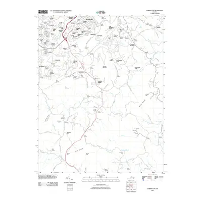
2011 Map of Garden City
USGS Topo · Published 2011About this map
The southern suburbs of Roanoke and the high ridges of the Blue Ridge dominate this 2011 landscape. The terrain transitions from established neighborhoods like Crystal Spring and Sherwood Forest in the north to the steeper elevations of Mill Mountain, Roanoke Mountain, and Buck Mountain. The Blue Ridge Pkwy snakes across the ridges, providing access to the Buck Mountain Overlook and connecting the residential corridors of Garden City and Clearbrook.
Find a feature on this map
151 named features on this map. Tap any name to fly to it.
Don’t see what you’re looking for? This feature index may not catch every label — zoom into the map to look around manually.
Map Details
Editions of this 2011 Garden City Map
This is the sole edition of this map. No revisions or reprints were ever made.
Other maps of this area

1890 · Roanoke
USGS Topo · 1:125,000

1890 · Christiansburg
USGS Topo · 1:125,000

1891 · Roanoke
USGS Topo · 1:125,000

1929 · Roanoke
USGS Topo · 1:48,000

1929 · Salem
USGS Topo · 1:48,000

1932 · Salem
USGS Topo · 1:62,500

1933 · Roanoke
USGS Topo · 1:62,500

1947 · Roanoke
USGS Topo · 1:250,000

1950 · Elliston
USGS Topo · 1:62,500

1951 · Boones Mill
USGS Topo · 1:62,500