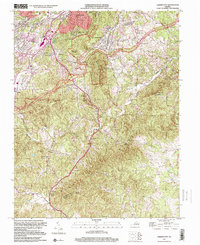
1999 Map of Garden City
USGS Topo · Published 2000About this map
Roanoke and the suburban communities of Garden City and Cave Spring transition into the steep slopes of the Blue Ridge Mountains in this late 20th-century survey. The landscape is defined by the winding route of the Blue Ridge Parkway, which traverses the high ground near Roanoke Mountain and Mill Mountain. Along these ridges, numerous family burial grounds such as Hogan Cem, Bandys Cem, and Gearheart Cem provide essential data for genealogists tracing local families like the Abshires, Turners, and Plunketts.
Find a feature on this map
58 named features on this map. Tap any name to fly to it.
Don’t see what you’re looking for? This feature index may not catch every label — zoom into the map to look around manually.
Map Details
Editions of this 1999 Garden City Map
This is the sole edition of this map. No revisions or reprints were ever made.
Other maps of this area

1890 · Roanoke
USGS Topo · 1:125,000

1890 · Christiansburg
USGS Topo · 1:125,000

1891 · Roanoke
USGS Topo · 1:125,000

1929 · Roanoke
USGS Topo · 1:48,000

1929 · Salem
USGS Topo · 1:48,000

1932 · Salem
USGS Topo · 1:62,500

1933 · Roanoke
USGS Topo · 1:62,500

1947 · Roanoke
USGS Topo · 1:250,000

1950 · Elliston
USGS Topo · 1:62,500

1951 · Boones Mill
USGS Topo · 1:62,500