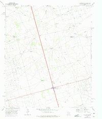
1968 Map of Gardendale
USGS Topo · Published 1975About this map
The North Cowden Oil Field and Midland Farms Oil Field dominate this Permian Basin landscape, where industrial infrastructure meets ranching heritage at the border of Andrews and Ector County. Settlement is clustered around the small hub of Gardendale and the named crossroads of Scharbauer City, connected by a network of roads and numerous pipelines that define the local economy.
Find a feature on this map
21 named features on this map. Tap any name to fly to it.
Don’t see what you’re looking for? This feature index may not catch every label — zoom into the map to look around manually.
Map Details
Editions of this 1968 Gardendale Map
2 editions found
Other maps of this area

1954 · Hobbs
USGS Topo · 1:250,000

1954 · Pecos
USGS Topo · 1:250,000

1957 · Pecos
USGS Topo · 1:250,000

1958 · Hobbs
USGS Topo · 1:250,000

1964 · Odessa NE
USGS Topo · 1:24,000

1964 · Odessa NW
USGS Topo · 1:24,000

1965 · Goldsmith
USGS Topo · 1:24,000

1967 · North Cowden
USGS Topo · 1:24,000

1968 · Baird Lake
USGS Topo · 1:24,000

1968 · Gardendale NW
USGS Topo · 1:24,000