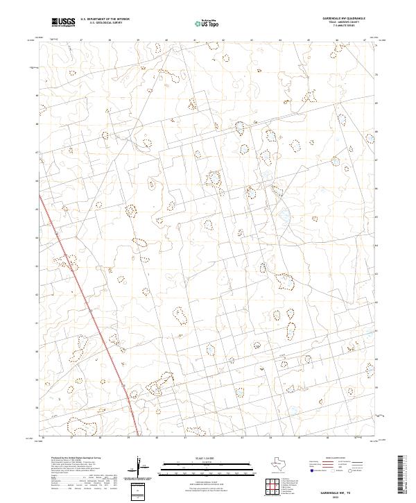
2022 Map of Gardendale NW
USGS Topo · Published 2022About this map
The High Plains of Andrews County are defined here by a geometric grid of rural routes and the diagonal path of Highway 385. This landscape, characterized by sparse vegetation and subtle depressions, represents the modern character of the Permian Basin's surface. Transport through the area relies on a strict network of surveyed roads including Se 8000, Sw 8000, and Se 5000. While the terrain appears uniform, the intermittent water features and road layouts reveal the systematic way this part of West Texas has been managed for resource access and travel between regional hubs.
Find a feature on this map
4 named features on this map. Tap any name to fly to it.
Don’t see what you’re looking for? This feature index may not catch every label — zoom into the map to look around manually.
Map Details
Editions of this 2022 Gardendale NW Map
This is the sole edition of this map. No revisions or reprints were ever made.
Other maps of this area

1954 · Hobbs
USGS Topo · 1:250,000

1958 · Hobbs
USGS Topo · 1:250,000

1963 · Andrews
USGS Topo · 1:24,000

1967 · North Cowden
USGS Topo · 1:24,000

1968 · Baird Lake
USGS Topo · 1:24,000

1968 · Gardendale NW
USGS Topo · 1:24,000

1968 · Clabber Hill Ranch
USGS Topo · 1:24,000
1968 · Hackberry Lake
USGS Topo · 1:24,000
1968 · Gardendale
USGS Topo · 1:24,000

1971 · Five Wells Ranch SE
USGS Topo · 1:24,000