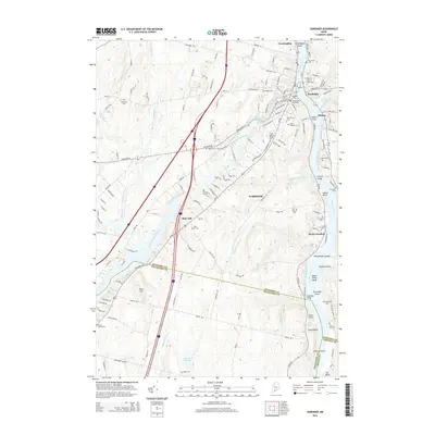
2014 Map of Gardiner
USGS Topo · Published 2014About this map
Gardiner serves as the focal point of this Kennebec River valley survey, where the river's path is marked by shoals and islands like Upper Sands Shoal and The Sands Island. The riverfront geography is defined by a series of points and coves, including Eastman Point, Trotts Point, and Lyons Cove, illustrating the historical importance of the waterway to local commerce. Inland, the landscape is bisected by the Cobbosseecontee Stream, which flows through the Cobbosseecontee Stream Reservoir before reaching the main river channel.
Find a feature on this map
146 named features on this map. Tap any name to fly to it.
Don’t see what you’re looking for? This feature index may not catch every label — zoom into the map to look around manually.
Map Details
Editions of this 2014 Gardiner Map
This is the sole edition of this map. No revisions or reprints were ever made.
Other maps of this area

1892 · Gardiner
USGS Topo · 1:62,500

1892 · Augusta
USGS Topo · 1:62,500

1893 · Vassalboro
USGS Topo · 1:62,500

1893 · Wiscasset
USGS Topo · 1:62,500

1898 · Vassalboro
USGS Topo · 1:62,500

1941 · Vassalboro
USGS Topo · 1:62,500

1941 · Augusta
USGS Topo · 1:62,500

1943 · Augusta
USGS Topo · 1:62,500

1943 · Gardiner
USGS Topo · 1:62,500

1943 · Vassalboro
USGS Topo · 1:62,500