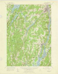
1957 Map of Gardiner
USGS Topo · Published 1959About this map
The Kennebec River corridor defines this mid-century landscape, serving as a primary artery for the industrial and agricultural towns of Gardiner, Richmond, and Randolph. The 1957 revision captures the region's transport evolution, showing the Maine Central railroad tracks paralleling the river while the Turnpike begins to carve through the interior of Litchfield. Local history is deeply embedded in the land, from the Water Iron-Mine Hill in Farmingdale to the educational roots at Litchfield Academy.
Find a feature on this map
100 named features on this map. Tap any name to fly to it.
Don’t see what you’re looking for? This feature index may not catch every label — zoom into the map to look around manually.
Map Details
Editions of this 1957 Gardiner Map
3 editions found
Other maps of this area

1892 · Gardiner
USGS Topo · 1:62,500

1892 · Freeport
USGS Topo · 1:62,500

1892 · Augusta
USGS Topo · 1:62,500

1893 · Vassalboro
USGS Topo · 1:62,500

1893 · Wiscasset
USGS Topo · 1:62,500

1893 · Boothbay
USGS Topo · 1:62,500

1894 · Bath
USGS Topo · 1:62,500

1898 · Vassalboro
USGS Topo · 1:62,500

1908 · Lewiston
USGS Topo · 1:62,500

1910 · Livermore
USGS Topo · 1:62,500