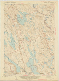
1943 Map of Gardner Lake
USGS Topo · Published 1943About this map
Gardner Lake and Cathance Lake dominate this 1943 interior landscape of Washington County, where the intricate network of the East Machias River and Machias River systems defines local navigation and industry. The map reveals a mid-century pattern of rural settlement anchored by the villages of Marion, Jacksonville, and Chase Mills. C. W. Buckey and his survey team meticulously documented the area's social infrastructure, including the Cooper Cemetery and several community centers like the East Ridge School and Smith Ridge School. A notable landmark is the Fire Tower atop Cooper Hill, which overlooks a rugged expanse of heaths and brooks. The inclusion of the MIT Camp on the shores of Gardner Lake indicates the area's established role for outdoor recreation and seasonal study during this era, while Maine 191 provides the primary transit link through the townships of Cooper and Marion.
Find a feature on this map
108 named features on this map. Tap any name to fly to it.
Don’t see what you’re looking for? This feature index may not catch every label — zoom into the map to look around manually.
Map Details
Editions of this 1943 Gardner Lake Map
3 editions found

Other maps of this area

1907 · Eastport
USGS Topo · 1:48,000

1908 · Eastport
USGS Topo · 1:62,500

1917 · Cutler
USGS Topo · 1:62,500

1918 · Machias
USGS Topo · 1:62,500

1918 · Cutler
USGS Topo · 1:62,500

1921 · Columbia Falls
USGS Topo · 1:62,500

1929 · Calais
USGS Topo · 1:48,000

1929 · Robbinston
USGS Topo · 1:48,000

1931 · Robbinston
USGS Topo · 1:62,500

1932 · Calais
USGS Topo · 1:62,500