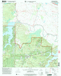
2003 Map of Gardner
USGS Topo · Published 2005About this map
Hot Wells and Gardner define the rural character of this Rapides Parish landscape, where the southern reaches of the Kisatchie National Forest meet a network of bayous and reservoirs. The area is anchored by significant water bodies, including Lake Cotile and the sprawling Kincaid Reservoir, which transformed the local drainage of Brown Creek and Wilda. This 2003 revision reveals a region deeply tied to its natural resources and community foundations, evidenced by the numerous country churches like Red Store Ch and Wilda Ch.
Find a feature on this map
47 named features on this map. Tap any name to fly to it.
Don’t see what you’re looking for? This feature index may not catch every label — zoom into the map to look around manually.
Map Details
Editions of this 2003 Gardner Map
This is the sole edition of this map. No revisions or reprints were ever made.
Other maps of this area

1932 · Boyce NE
USGS Topo · 1:31,680

1932 · Boyce SW
USGS Topo · 1:31,680

1937 · Chopin NE
USGS Topo · 1:31,680

1937 · Chopin SE
USGS Topo · 1:31,680

1941 · Boyce
USGS Topo · 1:62,500

1943 · Leander
USGS Topo · 1:62,500

1944 · Chopin
USGS Topo · 1:62,500

1945 · Boyce SE
USGS Topo · 1:31,680

1948 · Chopin
USGS Topo · 1:62,500

1949 · Boyce NW
USGS Topo · 1:31,680