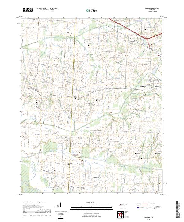
2022 Map of Gardner
USGS Topo · Published 2022About this map
Gardner and Mount Pelia sit at the center of this rural landscape where the border of Obion Co and Weakley Co divides the agricultural terrain. The map is heavily marked by family and community history, evidenced by a high density of small cemeteries including Gardner Cem, Shaddtown Cem, and Henry Cem. Waterways like Cypress Cr and its associated Cypress Creek Bottom define the drainage patterns, while Cane Cr and Mud Creek wind through the southern and central sections. The settlement of Martin appears on the eastern edge, showing the infrastructure of roads like University ST and Walmart DR near the municipal boundary. This topography illustrates the transition from the wet bottomlands of the Obion River to the upland farms and crossroads that have sustained these Tennessee counties for generations.
Find a feature on this map
107 named features on this map. Tap any name to fly to it.
Don’t see what you’re looking for? This feature index may not catch every label — zoom into the map to look around manually.
Map Details
Editions of this 2022 Gardner Map
This is the sole edition of this map. No revisions or reprints were ever made.
Other maps of this area

1950 · Martin
USGS Topo · 1:24,000

1950 · Rives
USGS Topo · 1:24,000

1951 · Rives
USGS Topo · 1:24,000

1954 · Rutherford
USGS Topo · 1:24,000

1954 · Greenfield
USGS Topo · 1:24,000

1954 · Union City
USGS Topo · 1:24,000

1956 · Gardner
USGS Topo · 1:24,000

1956 · Harris
USGS Topo · 1:24,000

1956 · Mc Connell
USGS Topo · 1:24,000

1956 · Dyersburg
USGS Topo · 1:250,000