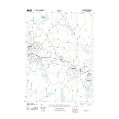
2012 Map of Gardner
USGS Topo · Published 2012About this map
Gardner and Westminster anchor a landscape defined by industrial waterpower and residential clusters in this 2012 study of Worcester County. The Whitman River and its numerous impoundments, including the Whitmanville Reservoir and Wrights Reservoir, illustrate the historical reliance on local waterways for community development. Educational and recreational landmarks are prominent, from the Mount Wachusett Community College campus to the Gardner Municipal Golf Course. Small enclaves like Olde English Village, South Gardner, and East Gardner provide a look at the distinct neighborhood identities that persisted into the twenty-first century. Genealogists will find the locations of Crystal Lake Cem, Woodside Cem, and Green Bower Cem useful for tracing local lineages, while the presence of Camp Collier and lakeside developments like Bakers Grove and Mantyranta highlight the area's transition into a modern mix of academic, residential, and seasonal life.
Find a feature on this map
200 named features on this map. Tap any name to fly to it.
Don’t see what you’re looking for? This feature index may not catch every label — zoom into the map to look around manually.
Map Details
Editions of this 2012 Gardner Map
This is the sole edition of this map. No revisions or reprints were ever made.
Other maps of this area

1885 · Worcester
USGS Topo · 1:62,500

1886 · Worcester
USGS Topo · 1:62,500

1887 · Winchendon
USGS Topo · 1:62,500

1887 · Barre
USGS Topo · 1:62,500

1887 · Fitchburg
USGS Topo · 1:62,500

1889 · Fitchburg
USGS Topo · 1:62,500

1889 · Barre
USGS Topo · 1:62,500

1890 · Winchendon
USGS Topo · 1:62,500

1892 · Worcester
USGS Topo · 1:62,500

1893 · Fitchburg
USGS Topo · 1:62,500