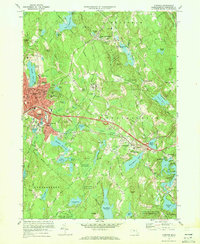
1970 Map of Gardner
USGS Topo · Published 1972About this map
The Boston and Maine Railroad corridors define the industrial and residential development of this Worcester County landscape, passing through Gardner and South Ashburnham before crossing into Westminster. The city center of Gardner is densely detailed, showing the City Hall, Library, and institutional landmarks like Heywood Memorial Hospital. To the east, the sprawling grounds of the Gardner State Hospital and the campus of Mt Wachusett Community College stand as significant mid-century fixtures.
Find a feature on this map
102 named features on this map. Tap any name to fly to it.
Don’t see what you’re looking for? This feature index may not catch every label — zoom into the map to look around manually.
Map Details
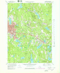
Editions of this 1970 Gardner Map
2 editions found
Other maps of this area

1885 · Worcester
USGS Topo · 1:62,500

1886 · Worcester
USGS Topo · 1:62,500

1887 · Winchendon
USGS Topo · 1:62,500

1887 · Barre
USGS Topo · 1:62,500

1887 · Fitchburg
USGS Topo · 1:62,500

1889 · Fitchburg
USGS Topo · 1:62,500

1889 · Barre
USGS Topo · 1:62,500

1890 · Winchendon
USGS Topo · 1:62,500

1892 · Worcester
USGS Topo · 1:62,500

1893 · Fitchburg
USGS Topo · 1:62,500