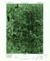
1975 Map of Gardner
USGS Topo · Published 1981About this map
Gardner and its surrounding Worcester County townships are depicted here through 1970s orthophotography, providing a clear record of the industrial and residential footprint during this era. The city's concentration of structures near the western edge of the sheet contrasts with the wooded corridors following the Whitman River toward South Ashburnham. This aerial perspective reveals the dense network of roads and clearings that characterize the mid-century expansion of Westminster and smaller settlements like Manty ranta.
Find a feature on this map
7 named features on this map. Tap any name to fly to it.
Don’t see what you’re looking for? This feature index may not catch every label — zoom into the map to look around manually.
Map Details
Editions of this 1975 Gardner Map
This is the sole edition of this map. No revisions or reprints were ever made.
Other maps of this area

1885 · Worcester
USGS Topo · 1:62,500

1886 · Worcester
USGS Topo · 1:62,500

1887 · Winchendon
USGS Topo · 1:62,500

1887 · Barre
USGS Topo · 1:62,500

1887 · Fitchburg
USGS Topo · 1:62,500

1889 · Fitchburg
USGS Topo · 1:62,500

1889 · Barre
USGS Topo · 1:62,500

1890 · Winchendon
USGS Topo · 1:62,500

1892 · Worcester
USGS Topo · 1:62,500

1893 · Fitchburg
USGS Topo · 1:62,500