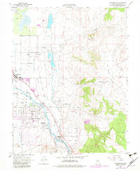
1969 Map of Gardnerville
USGS Topo · Published 1983About this map
Gardnerville serves as the focal point for this study of the Carson Valley floor during the late 1960s, showing a transition from agricultural roots to modern suburban development. The landscape is defined by an intricate network of irrigation and drainage, with the East Fork Carson River feeding the Allerman Canal and Upper Virginia Canal. These waterways, alongside features like Cottonwood Slough and Hennington Slough, illustrate the complex water management required to sustain life and industry in this high-desert environment.
Find a feature on this map
35 named features on this map. Tap any name to fly to it.
Don’t see what you’re looking for? This feature index may not catch every label — zoom into the map to look around manually.
Map Details
Editions of this 1969 Gardnerville Map
3 editions found
Other maps of this area

1889 · Markleeville
USGS Topo · 1:125,000

1891 · Carson
USGS Topo · 1:125,000

1891 · Markleeville
USGS Topo · 1:125,000

1893 · Carson
USGS Topo · 1:125,000

1893 · Markleeville
USGS Topo · 1:125,000

1948 · Walker Lake
USGS Topo · 1:250,000

1956 · Freel Peak
USGS Topo · 1:62,500

1956 · Dayton
USGS Topo · 1:62,500

1956 · Carson City
USGS Topo · 1:62,500

1957 · Walker Lake
USGS Topo · 1:250,000