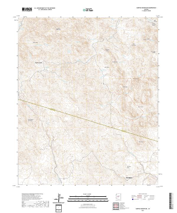
2021 Map of Garfias Mountain
USGS Topo · Published 2021About this map
The Hieroglyphic Mountains dominate this high-desert landscape northwest of the Phoenix metropolitan area, where the border between Yavapai Co and Maricopa Co cuts through the desert floor. This 2021 survey shows a terrain defined by ancient drainage patterns and mining history, notably at the Big Reef Mill site. Water sources are critical identifiers in this arid reach, marked by names like Saint Anthony Spring, J L Bar Spring, and Cross F Spring, which historically supported ranching and transit. The northeastern corner is punctuated by dramatic topographical features such as Big Hells Gate and Little Hells Gate along Bitter Cr. While the northern outskirts of Peoria appear at the southern edge, the map remains a study of the remote interior, including the family-named landmarks of Garfias Mtn and Shirttail Hills.
Find a feature on this map
51 named features on this map. Tap any name to fly to it.
Don’t see what you’re looking for? This feature index may not catch every label — zoom into the map to look around manually.
Map Details
Editions of this 2021 Garfias Mountain Map
This is the sole edition of this map. No revisions or reprints were ever made.
Other maps of this area

1887 · Prescott
USGS Topo · 1:250,000

1892 · Prescott
USGS Topo · 1:250,000

1903 · Bradshaw Mountains
USGS Topo · 1:125,000

1903 · Congress
USGS Topo · 1:125,000

1904 · Congress
USGS Topo · 1:125,000

1947 · Crown King
USGS Topo · 1:62,500

1947 · Wagoner
USGS Topo · 1:62,500

1948 · Crown King
USGS Topo · 1:63,360

1948 · Wagoner
USGS Topo · 1:63,360

1950 · Wagoner
USGS Topo · 1:62,500