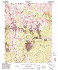
1994 Map of Garfield
USGS Topo · Published 1998About this map
Garfield sits at the eastern foot of the Continental Divide, where the South Arkansas River carves a path through the high peaks of the San Isabel National Forest. This late-twentieth-century revision reveals a landscape defined by industrial extraction and mountain recreation. High-elevation industrial sites like the Monarch Quarry and Hancock Mine illustrate the area's long-standing mining history, while the Monarch Ski Area and Continental Divide Trail represent the mid-century shift toward alpine tourism. The map documents significant water management infrastructure, including the North Fork Reservoir and Boss Lake Reservoir, essential for sustaining lower-elevation settlements. Further west, the Tomichi Cem near Hancock Pass provides a poignant connection to the early mining camps that once braved this high-altitude environment.
Find a feature on this map
60 named features on this map. Tap any name to fly to it.
Don’t see what you’re looking for? This feature index may not catch every label — zoom into the map to look around manually.
Map Details
Editions of this 1994 Garfield Map
This is the sole edition of this map. No revisions or reprints were ever made.
Other maps of this area

1940 · Garfield
USGS Topo · 1:62,500

1945 · Garfield
USGS Topo · 1:62,500

1956 · Poncha Springs
USGS Topo · 1:62,500

1956 · Montrose
USGS Topo · 1:250,000

1959 · Montrose
USGS Topo · 1:250,000

1959 · Bonanza
USGS Topo · 1:62,500

1960 · Montrose
USGS Topo · 1:250,000

1964 · Sargents
USGS Topo · 1:24,000

1967 · Pahlone Peak
USGS Topo · 1:24,000

1968 · Montrose
USGS Topo · 1:250,000