
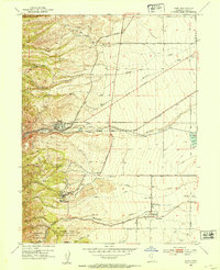
1952 Map of Garfield
USGS Topo · Published 1954About this map
Industrial expansion and the rugged northern slopes of the Oquirrh Mountains define this mid-century landscape along the Great Salt Lake. The shore serves as a major transportation and processing hub, anchored by the massive Copper Smelter and Refinery at Garfield, which are supported by a complex network including the Union Pacific Railroad and the Denver and Rio Grande Western Railroad. Near the shoreline, historical markers note the Site of First Utah Smelter and Pleasant Green Camp, grounding the heavy industry of the 1950s in the region's pioneering past.
Find a feature on this map
76 named features on this map. Tap any name to fly to it.
Don’t see what you’re looking for? This feature index may not catch every label — zoom into the map to look around manually.
Map Details
Editions of this 1952 Garfield Map
This is the sole edition of this map. No revisions or reprints were ever made.
Other maps of this area

1885 · Tooele Valley
USGS Topo · 1:250,000

1951 · Saltair
USGS Topo · 1:24,000

1952 · Magna
USGS Topo · 1:24,000

1952 · Bingham Canyon
USGS Topo · 1:24,000

1952 · Antelope Island South
USGS Topo · 1:24,000
1952 · Lark
USGS Topo · 1:24,000

1953 · Tooele
USGS Topo · 1:250,000

1955 · Mills Junction
USGS Topo · 1:24,000

1955 · Tooele
USGS Topo · 1:250,000

1955 · Tooele
USGS Topo · 1:24,000