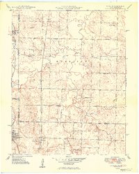
1949 Map of Garland
USGS Topo · Published 1949About this map
Garland and Arcadia anchor the western edge of this 1949 topographic study, straddling the state line where the St Louis - San Francisco and Kansas City Southern railroads parallel the border. The landscape is a mix of small rural communities and industrial activity, marked by numerous Strip Mines that have reshaped the terrain. Local social life is reflected in the dense network of country schools and churches, such as Glendale Sch, McKill Chapel, and Belmont Sch.
Find a feature on this map
34 named features on this map. Tap any name to fly to it.
Don’t see what you’re looking for? This feature index may not catch every label — zoom into the map to look around manually.
Map Details
Editions of this 1949 Garland Map
2 editions found
Other maps of this area

1884 · Fort Scott
USGS Topo · 1:125,000

1886 · Nevada
USGS Topo · 1:125,000

1886 · Fort Scott
USGS Topo · 1:125,000

1893 · Fort Scott
USGS Topo · 1:125,000

1894 · Nevada
USGS Topo · 1:125,000

1939 · Deerfield
USGS Topo · 1:24,000

1939 · Moundville
USGS Topo · 1:24,000

1942 · Deerfield
USGS Topo · 1:24,000
1942 · Moundville
USGS Topo · 1:24,000

1947 · Joplin
USGS Topo · 1:250,000