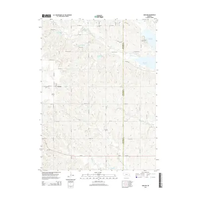
2014 Map of Garland
USGS Topo · Published 2014About this map
Garland sits at the intersection of a rolling agricultural landscape and an intricate network of modern water management. This 2014 survey captures the township's layout alongside several significant cemeteries that reflect the area's pioneer heritage, including Germantown Cem and Garland South Cem. The terrain is defined by the drainage of Middle Oak Cr and Elk Cr, which feed into the extensive Branched Oak Lake visible in the northeast corner. These waterways are part of a broader conservation and flood control system, illustrated by numerous engineered features like Oak-Middle Reservoir 76-A. The map also traces the county line between Seward County and Lancaster County, providing a clear look at how rural property lines and road networks, such as Alvo Rd and Waverly Rd, have persisted through the early 21st century.
Find a feature on this map
41 named features on this map. Tap any name to fly to it.
Don’t see what you’re looking for? This feature index may not catch every label — zoom into the map to look around manually.
Map Details
Editions of this 2014 Garland Map
This is the sole edition of this map. No revisions or reprints were ever made.
Other maps of this area

1897 · Lincoln
USGS Topo · 1:125,000

1899 · Wahoo
USGS Topo · 1:125,000

1899 · David City
USGS Topo · 1:125,000

1934 · Seward
USGS Topo · 1:48,000

1939 · Seward
USGS Topo · 1:62,500

1955 · Fremont
USGS Topo · 1:250,000

1955 · Lincoln
USGS Topo · 1:250,000

1957 · Fremont
USGS Topo · 1:250,000

1957 · Lincoln
USGS Topo · 1:250,000

1958 · Fremont
USGS Topo · 1:250,000