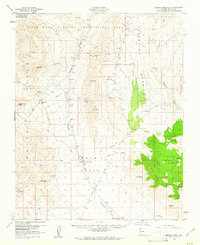
1960 Map of Garnet Mtn.
USGS Topo · Published 1961About this map
The gold-bearing landscapes of the Gold Basin and White Hills define this arid region of Mohave County during the early 1960s. Mining activity is heavily concentrated across the terrain, with specific operations like the King Tut Placer Mine, Golden Mile Mine, and Bluebird Mine linked by a network of jeep trails. These trails connect the high desert peaks, such as Golden Rule Peak and Iron Mtn, to isolated outposts of human settlement including Burnt Mill Ranch and Ray Place.
Find a feature on this map
47 named features on this map. Tap any name to fly to it.
Don’t see what you’re looking for? This feature index may not catch every label — zoom into the map to look around manually.
Map Details
Editions of this 1960 Garnet Mtn. Map
3 editions found
Other maps of this area

1886 · Diamond Creek
USGS Topo · 1:250,000

1886 · Camp Mohave
USGS Topo · 1:250,000

1886 · Saint Thomas
USGS Topo · 1:250,000

1886 · Mt. Trumbull
USGS Topo · 1:250,000

1892 · Diamond Creek
USGS Topo · 1:250,000

1892 · Mt. Trumbull
USGS Topo · 1:250,000

1892 · Camp Mohave
USGS Topo · 1:250,000

1893 · Saint Thomas
USGS Topo · 1:250,000

1926 · Bonelli
USGS Topo · 1:96,000

1942 · Camp Mohave
USGS Topo · 1:250,000