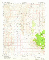
1960 Map of Garnet Mtn.
USGS Topo · Published 1966About this map
Gold Basin and the White Hills anchor this 1960s topographic study of Mohave County's arid northern reaches. The landscape is defined by extensive mining activity, featuring numerous operations such as the Golden Gate Mine, Climax Mine, and the King Tut Placer Mine. These industrial points are connected by a network of jeep trails and the notable Pierce Ferry Road, reflecting the difficulty of travel through the complex terrain of Grapevine Mesa and the Grand Wash Cliffs.
Find a feature on this map
46 named features on this map. Tap any name to fly to it.
Don’t see what you’re looking for? This feature index may not catch every label — zoom into the map to look around manually.
Map Details
Editions of this 1960 Garnet Mtn. Map
3 editions found
Other maps of this area

1886 · Diamond Creek
USGS Topo · 1:250,000

1886 · Camp Mohave
USGS Topo · 1:250,000

1886 · Saint Thomas
USGS Topo · 1:250,000

1886 · Mt. Trumbull
USGS Topo · 1:250,000

1892 · Diamond Creek
USGS Topo · 1:250,000

1892 · Mt. Trumbull
USGS Topo · 1:250,000

1892 · Camp Mohave
USGS Topo · 1:250,000

1893 · Saint Thomas
USGS Topo · 1:250,000

1926 · Bonelli
USGS Topo · 1:96,000

1942 · Camp Mohave
USGS Topo · 1:250,000