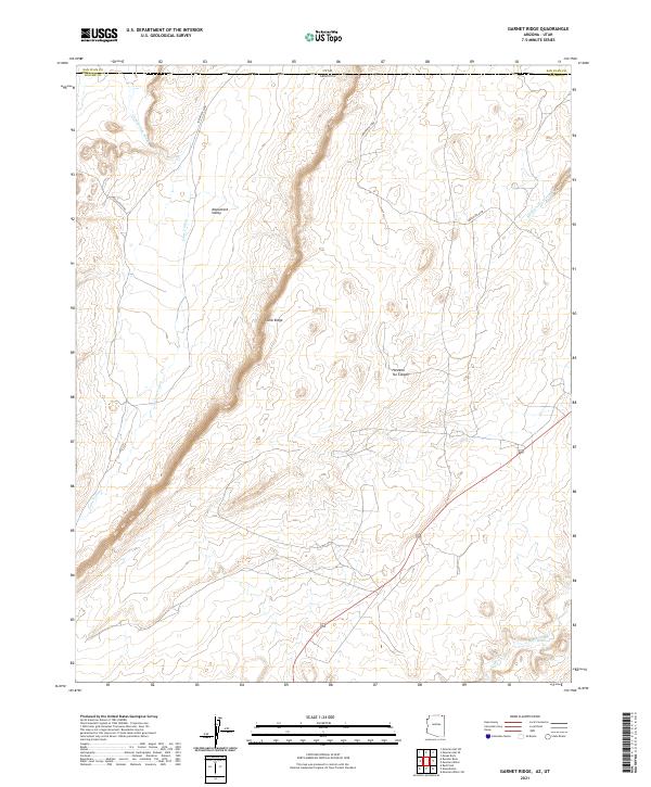
2021 Map of Garnet Ridge
USGS Topo · Published 2021About this map
Comb Ridge dominates this high-desert landscape on the border of Apache County, Arizona, and San Juan County, Utah. The massive monocline structure runs north-to-south, cutting through the eastern edge of Monument Valley. This 2021 survey details a region shaped by ephemeral drainages, where the Cane Valley Wash meanders through the broad floor of Cane Valley and the Hosteen Tso Wash carves its way through Hosteen Tso Canyon. The southern portion of the map captures the course of Laguna Cr, a vital water source in this arid terrain. Navigational access is defined primarily by Indian Rte 6440, which threads between the canyons and mesas, illustrating the sparse but critical transportation network connecting these remote tribal lands.
Find a feature on this map
15 named features on this map. Tap any name to fly to it.
Don’t see what you’re looking for? This feature index may not catch every label — zoom into the map to look around manually.
Map Details
Editions of this 2021 Garnet Ridge Map
This is the sole edition of this map. No revisions or reprints were ever made.
Other maps of this area

1886 · Abajo
USGS Topo · 1:250,000

1892 · Abajo
USGS Topo · 1:250,000

1892 · Canyon De Chelly
USGS Topo · 1:250,000

1893 · Abajo
USGS Topo · 1:250,000

1952 · Bluff 3 SE
USGS Topo · 1:24,000

1952 · Dinnehotso
USGS Topo · 1:62,500
1952 · Bluff 3 SW
USGS Topo · 1:24,000

1952 · Setsiltso Springs 2 NW
USGS Topo · 1:24,000

1952 · Setsiltso Springs 2 SW
USGS Topo · 1:24,000

1952 · Setsiltso Springs 2 SE
USGS Topo · 1:24,000