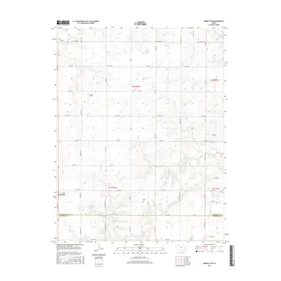
2015 Map of Garnett NW
USGS Topo · Published 2015About this map
Richmond sits at the southwestern edge of this landscape, serving as a focal point for a region defined by agricultural plots and the drainage basins of several meandering creeks. The terrain is a network of waterways including Middle Creek in the north and the multi-branched Sac Branch system to the east. Local history is etched into the land at Baker Cemetery and Berea Cemetery, while recreation and water management are represented by the presence of Richmond Lake and Gilkey Lake. The area's transportation and utility are marked by Cochran Airport and a grid of roads named for various states, such as Nebraska Road and Ohio Road. The southern portion of the map is defined by the Franklin and Anderson County line, which follows the path of Pottawatomie Creek.
Find a feature on this map
47 named features on this map. Tap any name to fly to it.
Don’t see what you’re looking for? This feature index may not catch every label — zoom into the map to look around manually.
Map Details
Editions of this 2015 Garnett NW Map
This is the sole edition of this map. No revisions or reprints were ever made.
Other maps of this area

1885 · Garnett
USGS Topo · 1:125,000

1885 · Lawrence
USGS Topo · 1:125,000

1889 · Lawrence
USGS Topo · 1:125,000

1894 · Garnett
USGS Topo · 1:125,000

1947 · Lawrence
USGS Topo · 1:250,000

1950 · Lawrence
USGS Topo · 1:250,000

1956 · Ottawa South
USGS Topo · 1:24,000

1956 · Lawrence
USGS Topo · 1:250,000

1961 · Lawrence
USGS Topo · 1:250,000
1962 · Peoria
USGS Topo · 1:24,000