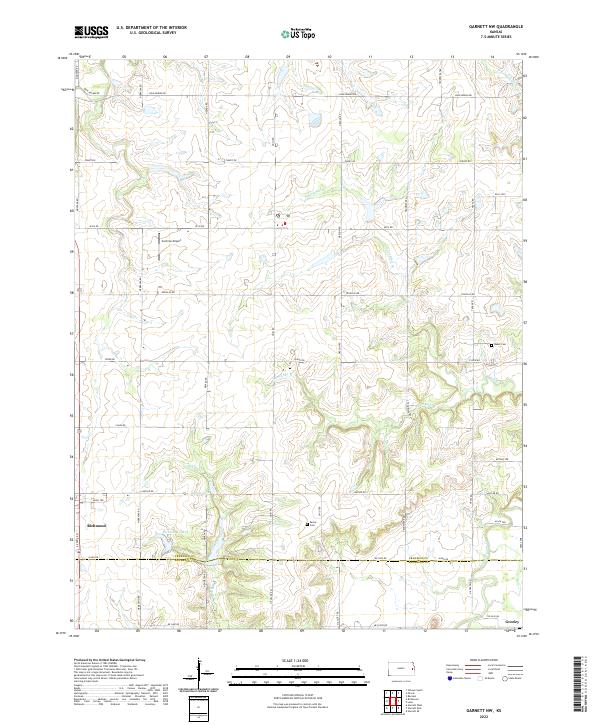
2022 Map of Garnett NW
USGS Topo · Published 2022About this map
The boundary between Franklin and Anderson County divides this rural landscape, where the prairie gives way to the winding drainage basins of Pottawatomie Cr and its various tributaries. This 2022 survey captures the small-town layout of Richmond in the southwest and Greeley at the southeastern edge, connected by a network of sectional roads named for states and early settlers.
Find a feature on this map
50 named features on this map. Tap any name to fly to it.
Don’t see what you’re looking for? This feature index may not catch every label — zoom into the map to look around manually.
Map Details
Editions of this 2022 Garnett NW Map
This is the sole edition of this map. No revisions or reprints were ever made.
Other maps of this area

1885 · Garnett
USGS Topo · 1:125,000

1885 · Lawrence
USGS Topo · 1:125,000

1889 · Lawrence
USGS Topo · 1:125,000

1894 · Garnett
USGS Topo · 1:125,000

1947 · Lawrence
USGS Topo · 1:250,000

1950 · Lawrence
USGS Topo · 1:250,000

1956 · Ottawa South
USGS Topo · 1:24,000

1956 · Lawrence
USGS Topo · 1:250,000

1961 · Lawrence
USGS Topo · 1:250,000
1962 · Peoria
USGS Topo · 1:24,000