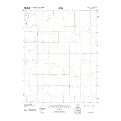
2009 Map of Garnett SE
USGS Topo · Published 2009About this map
Greeley anchors the northwestern corner of this eastern Kansas landscape, situated near the confluence of several rural roads and small watercourses. The territory is defined by a dense grid of named thoroughfares, such as West Virginia Rd, Wyoming Rd, and Baskerville Rd, reflecting the established agricultural section lines of Anderson County. Several waterways including Middle Creek, Landers Creek, and Goodrich Creek wind through the acreage, providing natural drainage for the surrounding farms. For genealogists and local historians, the map identifies specific resting places including Wait Cemetery in the northeast and Sutton Valley Cemetery further west. This 2009 edition serves as a record of the rural road network and settlement patterns before the continued modernization of the regional infrastructure.
Find a feature on this map
31 named features on this map. Tap any name to fly to it.
Don’t see what you’re looking for? This feature index may not catch every label — zoom into the map to look around manually.
Map Details
Editions of this 2009 Garnett SE Map
This is the sole edition of this map. No revisions or reprints were ever made.
Other maps of this area

1885 · Garnett
USGS Topo · 1:125,000

1887 · Mound City
USGS Topo · 1:125,000

1893 · Mound City
USGS Topo · 1:125,000

1894 · Garnett
USGS Topo · 1:125,000

1947 · Lawrence
USGS Topo · 1:250,000

1950 · Lawrence
USGS Topo · 1:250,000

1956 · Lawrence
USGS Topo · 1:250,000

1961 · Lawrence
USGS Topo · 1:250,000

1963 · Parker
USGS Topo · 1:24,000
1963 · Osawatomie
USGS Topo · 1:24,000