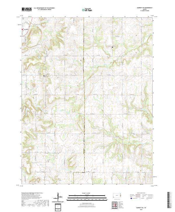
2022 Map of Garnett SE
USGS Topo · Published 2022About this map
Greeley anchors the northwestern corner of this Kansas landscape, where the prairie topography is defined by the winding paths of Middle Cr and Landers Cr. The map reveals a highly structured rural grid system, with named routes like NE Woodson Rd and Ayers Rd delineating property lines and township divisions. The presence of Wait Cem and Sutton Valley Cem highlights the longstanding family roots established along the border of Anderson Co and Linn Co. This survey documents the persistent settlement patterns of eastern Kansas, where the intersection of traditional land-use boundaries and natural watercourses like Goodrich Cr continues to shape the agricultural community.
Find a feature on this map
51 named features on this map. Tap any name to fly to it.
Don’t see what you’re looking for? This feature index may not catch every label — zoom into the map to look around manually.
Map Details
Editions of this 2022 Garnett SE Map
This is the sole edition of this map. No revisions or reprints were ever made.
Other maps of this area

1885 · Garnett
USGS Topo · 1:125,000

1887 · Mound City
USGS Topo · 1:125,000

1893 · Mound City
USGS Topo · 1:125,000

1894 · Garnett
USGS Topo · 1:125,000

1947 · Lawrence
USGS Topo · 1:250,000

1950 · Lawrence
USGS Topo · 1:250,000

1956 · Lawrence
USGS Topo · 1:250,000

1961 · Lawrence
USGS Topo · 1:250,000

1963 · Parker
USGS Topo · 1:24,000
1963 · Osawatomie
USGS Topo · 1:24,000