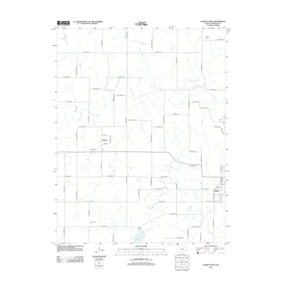
2012 Map of Garnett West
USGS Topo · Published 2012About this map
Pottawatomie Cr and its tributaries, including Sac Cr, Fish Cr, and Lantha Cr, weave through this western Anderson County landscape, defining the local drainage patterns. The area is characterized by a grid of rural roads and scattered farmsteads, with the small settlement of Glenlock situated near the center of the sheet along NW Jewel Rd. The western edge of Garnett is visible in the southeast, showing the transition from municipal street grids like W 4th Ave to the expansive section lines of the surrounding countryside.
Find a feature on this map
56 named features on this map. Tap any name to fly to it.
Don’t see what you’re looking for? This feature index may not catch every label — zoom into the map to look around manually.
Map Details
Editions of this 2012 Garnett West Map
This is the sole edition of this map. No revisions or reprints were ever made.
Other maps of this area

1885 · Garnett
USGS Topo · 1:125,000

1894 · Garnett
USGS Topo · 1:125,000

1947 · Lawrence
USGS Topo · 1:250,000

1950 · Lawrence
USGS Topo · 1:250,000

1956 · Williamsburg
USGS Topo · 1:24,000

1956 · Lawrence
USGS Topo · 1:250,000

1961 · Lawrence
USGS Topo · 1:250,000
1965 · Richmond
USGS Topo · 1:24,000
1966 · Bush City
USGS Topo · 1:24,000
1966 · Westphalia
USGS Topo · 1:24,000