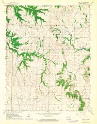
1966 Map of Bush City
USGS Topo · Published 1967About this map
Bush City sits near the eastern edge of this mid-1960s Kansas landscape, a period when the local economy was defined by a mix of agriculture and extraction. The extensive Oil Field labels across the northern townships point to the region's energy production history, while numerous Gravel Pits and a Quarry indicate active land use for construction materials. The terrain is deeply carved by the South Fork Pottawatomie Creek and its tributaries, including Sugar Creek and Saline Creek, creating a network of drainage that dictated settlement and road placement.
Find a feature on this map
21 named features on this map. Tap any name to fly to it.
Don’t see what you’re looking for? This feature index may not catch every label — zoom into the map to look around manually.
Map Details
Editions of this 1966 Bush City Map
2 editions found
Other maps of this area

1885 · Garnett
USGS Topo · 1:125,000

1894 · Garnett
USGS Topo · 1:125,000

1947 · Lawrence
USGS Topo · 1:250,000

1950 · Lawrence
USGS Topo · 1:250,000

1956 · Lawrence
USGS Topo · 1:250,000

1961 · Lawrence
USGS Topo · 1:250,000
1966 · Garnett East
USGS Topo · 1:24,000
1966 · Centerville
USGS Topo · 1:24,000
1966 · Welda
USGS Topo · 1:24,000
1966 · Garnett SE
USGS Topo · 1:24,000